
Wednesday, December 10, 2014
Tuesday, December 2, 2014
Blog Assignment #10

The map displayed here is one of possible sinkhole locations across the United States as of 1972. The karst landscapes shown here by two different colors make up the first variable while the lines for shading make up the second variable representing evaporite rocks that are known to be in an area.
Collected from:
http://ga.water.usgs.gov/edu/earthgwsinkholes.html
Blog Assignment #9

One dot represents one McDonald's. Interesting how many we have in the United States.
Collected from:
https://feszgis.wordpress.com/2012/02/06/mapping-density/

Blog Assignment #7
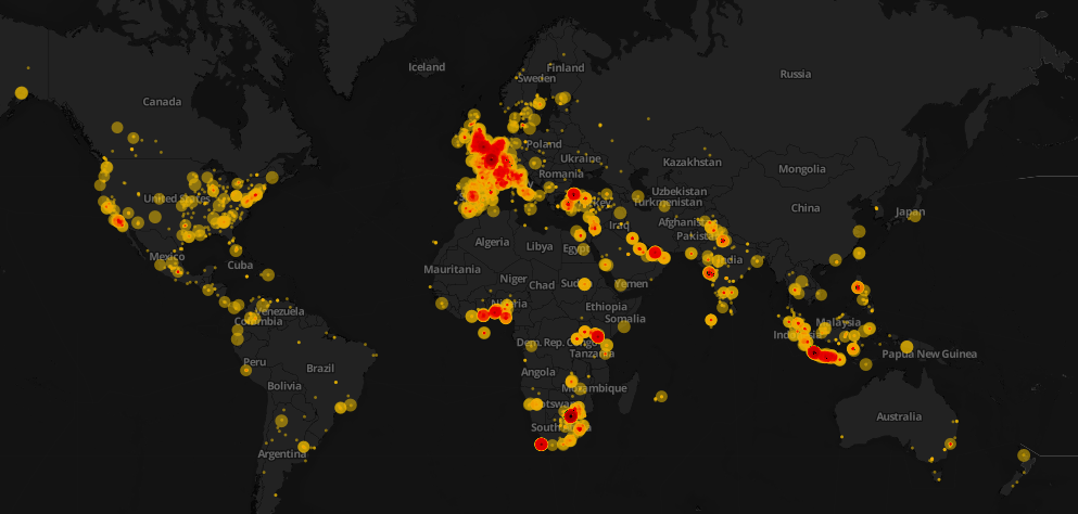
This Proportional symbol map is the worlds tweets of Nelson Mandela's death.
Collected from:
http://schoolofdata.org/tag/mapping/
Tuesday, November 18, 2014

Tuesday, November 11, 2014

Subscribe to:
Posts (Atom)